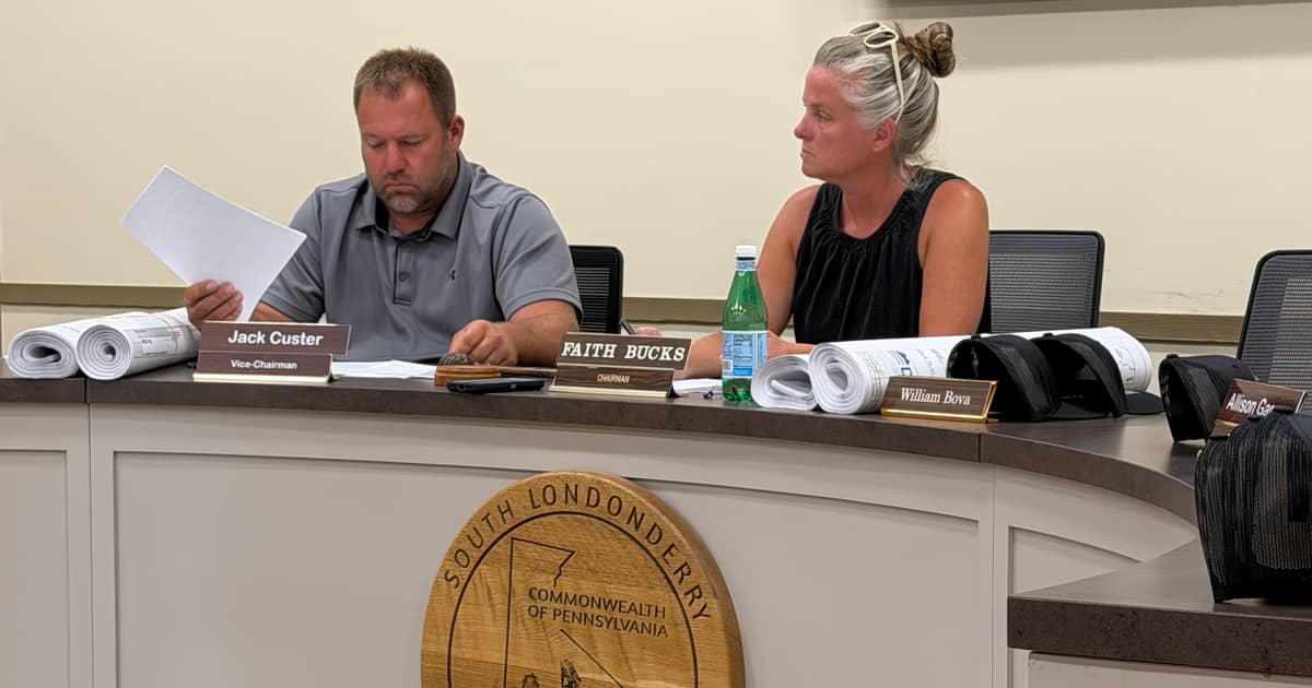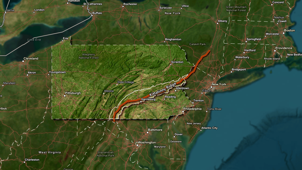
Kittatinny Ridge, a diverse, 250-mile-long stretch along the Appalachian Mountains from northern Maryland to New York’s Catskill Mountains that includes Fort Indiantown Gap in its span, has been designated a Sentinel Landscape by the federal government.
According to a multimedia presentation shared on May 15 by Joshua VanBrakle, of the Pennsylvania Department of Conservation and Natural Resources, Kittatinny Ridge sprawls over 185 miles in Pennsylvania and “is among the state’s most climate-resilient landscapes.”
VanBrakle, in his presentation, said the Sentinel Landscape encompasses about 1.9 million acres, including portions of nine counties and more than 160 municipalities. It is home to more than half a million Pennsylvanians, includes some of Pennsylvania’s best farmland and contains thousands of acres of working forests. The Ridge also contributes to the commonwealth’s $17 billion outdoor recreation industry through its many state parks, forests, and game lands.
Gov. Josh Shapiro said in a press release May 15 that the Sentinel Landscapes Partnership was founded in 2013 by the U.S. departments of Agriculture, Defense, and the Interior with the mission to “strengthen military readiness, conserve natural resources, bolster agricultural and forestry economies, increase public access to outdoor recreation, and enhance resilience to climate change.”
The designation, Shapiro’s statement explained, “means federal agencies, state and local governments, and non-governmental organizations come together to work with willing landowners and land managers to advance sustainable, mutually beneficial land-use practices around military installations. Land and natural resources within the landscape boundary could be protected through conservation easements with landowners or receive priority consideration for participation in grant and assistance programs so farms can keep farming and wildlands stay wild.”
Kittatinny Ridge is now one of 18 designated Sentinel Landscapes in the nation. According to a statement from the USDA, Kittatinny Ridge was one of five regions to receive the designation this year; the others were in eastern New Mexico, the Great Salt Lake area in Utah, the Mojave Desert region in California, and an area spanning the Hawaiian islands of Kauai, Oahu and Hawaii in the Pacific.
Forest Service Chief Randy Moore said the USDA is “committed to investing in sustainable land use practices with our fellow federal partners in the spirit of shared stewardship. The Sentinel Landscapes Partnership provides support to military readiness while securing conservation benefits, bolstering forest economies, increasing public access to outdoor recreation, and providing wildfire risk reduction for communities.”
“Through the Sentinel Landscapes Partnership, we have worked with private landowners to permanently protect more than 515,000 acres and implement sustainable management practices on an additional 2.7 million acres around military testing and training areas,” added Terry Cosby, USDA Natural Resources Conservation Service Chief. “These efforts preserve wildlife habitat, bolster agricultural and forest production, and support climate resiliency, among other benefits, while at the same time ensuring our military has the space it needs for its operations. This work showcases the power of collaboration and partnership to help us meet our mission.”
Brendan Owens, Assistant Secretary of Defense for Energy, Installations and Environment, said in a statement that the federal partnership “provides DOD with the unique opportunity to expand and diversify our partnerships with non-governmental organizations, state and local governments, Tribes and land managers to enhance the resilience of military installations and the local communities that support them.”
Besides Fort Indiantown Gap, the ridge also is home to military facilities including Letterkenny Army Depot, the Carlisle Barracks, and the Naval Support Activity in Mechanicsburg, as well as the state capital, Harrisburg.
According to the release from Shapiro’s office, the new designation “will help fortify existing conservation efforts, protecting the natural habitat and the training missions of the Pennsylvania National Guard and air and missile defense at Letterkenny Army Depot. Additionally, the 50 different federal, state, local, and private entities who helped secure the designation will continue to work together to pursue funding opportunities for the landscape, to continue to protect the robust natural resources in the area, and to make sure Fort Indiantown Gap remains a leading military installation.”
Shapiro said in a statement that the Sentinel Landscape designation “cements Fort Indiantown Gap’s) status as a critically important area for our national security.”
According to the release, federal, state, and local governments own about 17% of the landscape, while private landowners hold most of the land.
Major Gen. Mark Schindler, Pennsylvania’s adjutant general and head of the Department of Military and Veterans Affairs, noted in a release that Fort Indiantown Gap “is the busiest National Guard training facility in the nation” and the designation “assists in protecting critical land and air space our service members and civilian partners train in, while demonstrating our commitment to preserving our natural resources and farmland.”
The Kittatinny Ridge also plays a critical role in Pennsylvania’s rural economy, the release from Shapiro’s office noted. After receiving a Regional Conservation Partnership Program grant in 2019, it says, the state Department of Agriculture led a $10 million USDA Natural Resources Conservation Service grant-funded project to preserve and steward farms near and along the Kittatinny Ridge. “To date, more than 2,200 acres of land have been protected through this effort, and the project is ongoing,” the release says.
“Every farm that commits to conservation or preservation secures Pennsylvania’s future, safeguarding productive farmland for generations to come,” said Agriculture Secretary Russell Redding.
Department of Conservation and Natural Resources Secretary Cindy Adams Dunn said a study by the Nature Conservancy showed that Kittatinny Ridge was “the most climate resilient landscape in Pennsylvania, providing an unbroken area for plants and animals to move to higher elevations as the climate gets increasingly warmer and habitats change.” Scott Bearer, chief land manager for the Pennsylvania Game Commission, also noted that Kittatinny Ridge is designated as an Important Bird Area and serves as a premier raptor migration corridor in the northeastern United States.
According to VanBrakle’s presentation, the Kittatinny Ridge Conservation Landscape “has united partners to protect one of the most biodiverse regions of eastern North America” for 25 years and is globally recognized as a corridor “for rare wildlife, bird migration, clean water, and carbon sequestration,” including more than 160 miles of the Appalachian National Scenic Trail, 10 state parks, and more than 250 local parks.

According to the presentation, the landscape includes 1.1 million acres of forest, 465,000 acres of cropland, 202,000 acres of built area, 106,000 acres of rangeland, and 26,000 acres of water. About 83 percent of the area is privately owned, although more than 20 percent of the land area has been protected.
Although the region is also home to the nation’s busiest National Guard training center, VanBrakle said, it is threatened by “development, outsized population growth, and land fragmentation.”
However, the region is treated, VanBrakle’s report says, because “the same strategic location and large open spaces that make the Ridge so valuable for military readiness also make it a popular region for residential, commercial, and energy development.”
“Relatively low land cost and a lack of zoning along much of the Ridge have resulted in sprawling warehouses, overtaxed infrastructure, increased impervious surface, and potentially disruptive energy projects,” he states. “This development threatens the Ridge’s globally significant natural resources, climate resilience capacity, and military training capabilities.”
The region’s proximity to major metropolitan areas and its many major highways means it faces high development pressure,” the report says. “Many of Pennsylvania’s fastest-growing municipalities are in the Sentinel Landscape, according to U.S. Census data.”
According to the presentation, the region lost 24,000 acres of farmland and gained 16,000 acres of built area from 2018 to 2022.
“Although the Kittatinny Ridge faces threats, for now it remains a largely intact, working rural landscape,” VanBrakle’s report concludes. “The recreational revenues, natural system services, national defense capabilities, and farm and forest products the Ridge provides are worth billions annually to local communities.”
Questions about this story? Suggestions for a future LebTown article? Reach our newsroom using this contact form and we’ll do our best to get back to you.

Build the future of local news.
Cancel anytime.
Monthly Subscription
🌟 Annual Subscription
- Still no paywall!
- Fewer ads
- Exclusive events and emails
- All monthly benefits
- Most popular option
- Make a bigger impact
Already a member? Log in here to hide these messages
Local news is disappearing across America, but not in Lebanon County. Help keep it that way by supporting LebTown’s independent reporting. Your monthly or annual membership directly funds the coverage you value, or make a one-time contribution to power our newsroom. Cancel anytime.