
It would be easy, at first blush, to discount Lebanon County’s contribution to the Appalachian National Scenic Trail.
Known as the “A.T.” for short, it stretches about 2,190 miles from Springer Mountain, Georgia, north to Katahdin, Maine. Passing through 14 states, it’s the longest hiking-only footpath in the world, according to the Appalachian Trail Conservancy, the advocacy organization that looks after it.
About 230 of those miles – 11 percent of the trail altogether – pass through Pennsylvania. They’re special for a couple of reasons, said Ann Simonelli, communications director for the conservancy.

The A.T. is a unit of the National Park Service. But that agency doesn’t own all of the land the trail crosses. In Pennsylvania, for example, it winds in and out of seven State Game Lands owned by the Pennsylvania Game Commission and managed primarily for hunting and trapping. In other places, it crosses agricultural lands, Simonelli said.
That “illustrates the unique diversity of the cooperative management system that governs the A.T.,” she added.
Then, there’s what the trail looks like.
“The A.T. in Pennsylvania plays an important role in showcasing America’s heritage and the state’s sweeping landscapes, passing historic landmarks and ascending to scenic heights along Kittatinny Ridge,” Simonelli said.
That’s where the 11 or so miles in Lebanon County stand out.
Barry Webb is president of Blue Mountain Eagle Climbing Club, one of the 10 hiking clubs in Pennsylvania that maintain a portion of the trail, clearing blowdowns, building bridges, moving rocks, and doing whatever else is needed to keep it passable. Its 65-mile section runs from Berks County south (it looks like west on a map) to Rausch Gap, the site of an abandoned coal-mining village.
The Berks County portion of the trail is one of those that causes people to say the A.T. here runs through “Rocksylvania.”
“And we’re proud of it. We drag more rocks up there every year,” Webb said jokingly.
The Lebanon County portion of the A.T., by comparison, is rich in history and natural attractions.
“For [a] geek like me, there’s a lot of stuff there,” added Webb. “It’s an interesting part of the trail.”
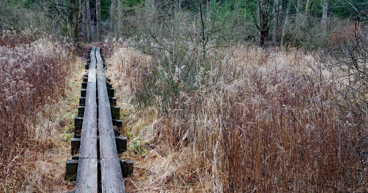
But you’ve got to work to see it, or at least some of it. The A.T. in Lebanon County is isolated, especially in comparison to the rest of the state. It’s part of the Stony Valley – or Saint Anthony’s Wilderness, as it was originally called – which is the second-largest roadless tract in Pennsylvania.
“The thing with our section, and particularly the part in Lebanon County and leading up to it, it’s the most remote section in Pennsylvania as far as road access goes,” said Mark Press, president of the Susquehanna Appalachian Trail Club, which maintains about 20.5 miles of the A.T. from Rausch Gap south through the rest of Lebanon County to Route 225, where the York Hiking Club takes over.
“You’re not really going to be able to get to it by just walking half a mile or three-quarters of a mile from some road in most places. You might have to go at least a mile. And for the shorter routes, you’re going to have to do some climbing as part of that.”
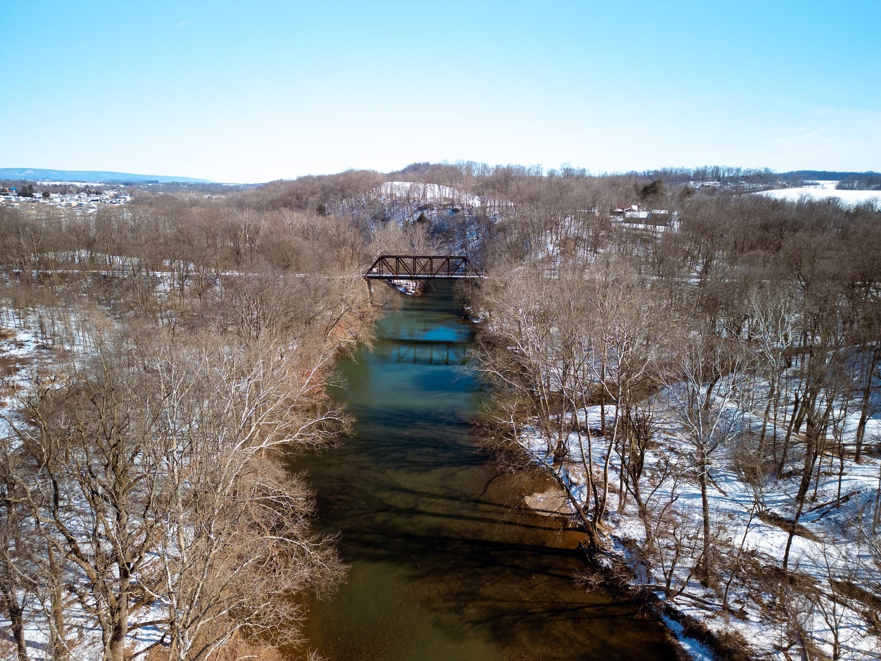
There are exceptions, if only a few. The trail is easiest to access where it runs through Swatara State Park, Webb noted. At one point, it crosses over the historic Waterville Bridge, a steel span relocated here years ago. At another, after crossing Route 443 and Green Point School Road, it enters what was once known as Pipefitter’s Field, an 18-acre opening in the woods that was long abused.

The Blue Mountain Club is restoring it, giving it a new name – Swatara Meadow – mowing it every other year and working to replant it with native wildflowers and grasses. It gives hikers a nice break from the “Green Tunnel” or endless tree cover they walk beneath when heading north through the Mid-Atlantic region.
“It’s the only open field of that size between New Jersey and the Cumberland Valley,” Webb said. “So, it’s a nice change of pace.”
The A.T. in Lebanon County is also home to the Rausch Gap shelter, a place where hikers of the long-distance variety or those tackling the trail in smaller chunks – can spend the night. There are 27 shelters in Pennsylvania overall, Simonelli said. This one was built in 1972 and refurbished in 1990.
It’s well maintained, if spartan as shelters tend to be. But it has one creature comfort few others do: water that’s easy to hand. It runs from a nearby spring through a pipe to the front of the shelter, collecting in a metal trough.
“I’ve hiked about 90 percent of the entire trail, and this is one of the unique features of this shelter,” Webb said. “You don’t often have water that accessible to you. It doesn’t happen that way very often.”
There’s lots of history along the A.T. in Lebanon County, too, Press added.
Rausch Gap was once a thriving community, where coal was mined and sent to Harrisburg and elsewhere on the Susquehanna and Schuylkill Railroad. It’s long gone, of course, but building foundations and an old cemetery remain.
“You can occasionally still find coal laying on the ground there, stuff that spilled,” Press said.
Further along are what’s left of Cold Spring. Site of a resort in the mid-1800s, it later became a summer camp for boys, military training grounds, and, finally, part of State Game Land 211. Further still lies what’s left of Yellow Springs, another town that sprung up with the railroad. There, too, you can see old foundations and whatnot, Press added.
Nature abounds along the trail as well. Press said one feature that stands out is a big beaver dam that may or may not still be in use.
Webb’s club built a detour around the resulting pond to give hikers a dry, alternate route. Some use it. Others don’t, walking directly across the dam to save a few steps, Webb said.
Some of those are “through hikers,” or people who walk the A.T. end to end in one four- to six-month walk, walking every day, day after day. That’s as challenging as it sounds.
Larry Luxenberg is a New Yorker who serves as president of the Appalachian Trail Museum. The nation’s only museum dedicated to hiking, it’s housed in a 200-year-old grist mill in Pine Grove Furnace State Park near Gardners.
He estimated that 4,000 to 5,000 people start on the trail each year, intending to go the distance. Maybe 1,000 actually succeed. He did it in 1980, celebrating his 25th birthday in or very near Lebanon County, somewhere in Stony Valley.
The experience was, he recalls, rewarding, but oh so difficult.
“I was on the trail for a little over two weeks, and I felt like a real veteran. I felt like I’d been on the trail for a long time,” Luxenberg said. “And I got to the middle of Great Smoky Mountain National Park, and I saw this sign, 1,850 miles to Maine. And it was like someone had given me a punch in the gut.
“Nobody knows until they actually get out there whether they’re going to want to finish. It’s physically hard, and it’s mentally hard. For the right person, it’s great. For the wrong person, it’s not good.”
Press said that’s not for him. He’s done backpacking trips of as many as 12 days, “but I like to take showers fairly frequently.”
The A.T. in Lebanon County is wonderful to explore in pieces, though, he added. People can, as Webb said, get on in Swatara State Park, where it’s easy. Another option for the more adventurous is to park in the State Game Land 211 parking lot on Gold Mine Road. Following the Stony Creek Rail Trail south and west for about three miles leads to an intersection with the A.T., Press added.
A lot of people – 1,600-plus volunteers in Pennsylvania alone – work hard to keep the A.T. viable year after year, Simonelli said. It’s great to see hikers of all abilities and desires out using it, in Lebanon County and elsewhere.
“Thousands and thousands and thousands of people have been involved in every aspect of building and maintaining the trail, almost all of them volunteers” Luxenberg added. “That makes it a very unique project for something of its scale.”
Learn more
To learn more about the Appalachian Trail Conservancy, visit appalachiantrail.org.
For information on the Appalachian Trail Museum, visit atmuseum.org.
To get involved with or become a member of the Blue Mountain Eagle Climbing Club, visit bmecc.org. The group does more than just work on the A.T., hosting hikes, and helping with kestrel nest boxes, bike rides, camping trips, and more.
To get involved with the Susquehanna Appalachian Trail Club, which likewise hosts a variety of events that potential new members can participate in, visit satc-hike.org.
Editor’s note: This article was updated after publication to correct the name of the Appalachian Trail’s southern terminus, which is Springer Mountain, not Spring Mountain as originally stated.
Questions about this story? Suggestions for a future LebTown article? Reach our newsroom using this contact form and we’ll do our best to get back to you.
Support Lebanon County journalism.
Cancel anytime.
Monthly Subscription
🌟 Annual Subscription
- Still no paywall!
- Fewer ads
- Exclusive events and emails
- All monthly benefits
- Most popular option
- Make a bigger impact
Already a member? Log in here to hide these messages
Strong communities need someone keeping an eye on local institutions. LebTown holds leaders accountable, reports on decisions affecting your taxes and schools, and ensures transparency at every level. Support this work with a monthly or annual membership, or make a one-time contribution. Cancel anytime.