Lebanon County was a very different place when F.W. Beers published his atlas of the region 150 years ago.
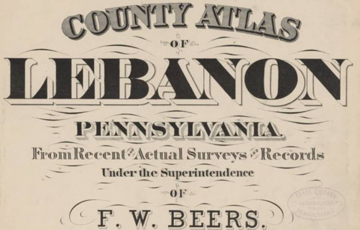
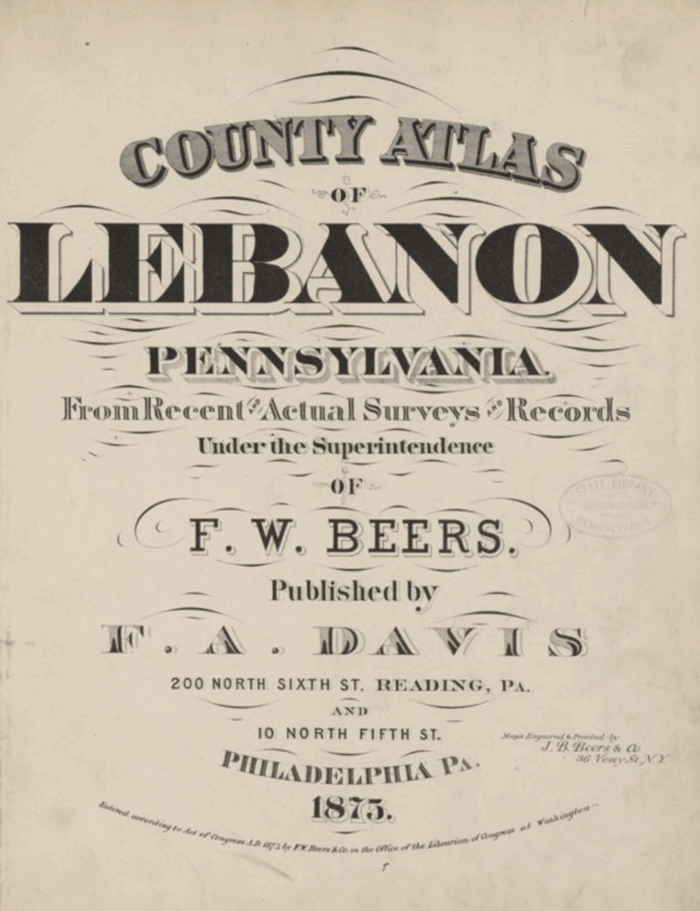
Although copies of the “County Atlas of Lebanon Pennsylvania From Recent and Actual Surveys and Records Under the Superintendence of F.W. Beers,” printed by F.A. Davis, a Reading- and Philadelphia-based publisher, in 1875, are scarce, it’s available to peruse online – for free – through the state archives.
On the occasion of the book’s sesquicentennial, LebTown decided to take a look through its tattered pages to see what treasures could be found. We encourage readers to do the same, and let us know in the comments what interesting facts, tidbits, and changes in topography you find!
But first, a little about the book and its author.
Copies of the atlas sell for hundreds of dollars. For instance, High Ridge Books, a dealer specializing in 19th- and early 20th-century original books, maps, and other printed materials based in western Massachusetts, list a copy of the Beers atlas for $650.
Their description of the book is as follows: “Original full cloth, disbound. Title and contents leaves chipped. Maps are generally good, though with chipping at the edges of some maps. 33 colored maps, identifying landowners. Many woodcut views of houses & businesses. One of the pages of views is printed in color. There are five pages of views which the contents leaf indicate are on pages designated with an appended letter A which are not present here. It seems likely that this copy of the atlas was compiled without those appended sheets.”
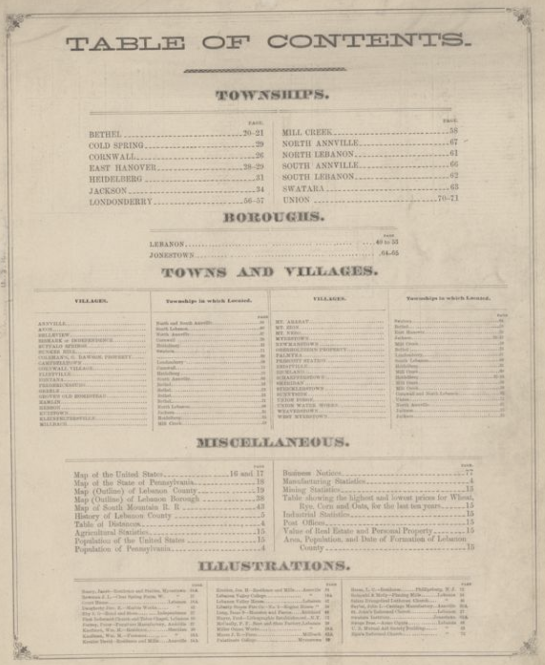
A complete volume is 81 pages, according to a list of Pennsylvania Classic County Atlases compiled on the Historical Maps of Pennsylvania website.
Although copies for sale are hard to find online, the Lebanon County Historical Society lists a black-and-white reprint of the atlas in its library. The library listing does not say when the atlas was reprinted.
Masthof Press and Bookstore, based in Morgantown, offers a PDF collection of scans from the Beers atlas and other sources for $10.
Geographicus, an online dealer in rare antique maps, does not have a copy of the Lebanon atlas in stock, but offers a handful of other Beers maps for prices ranging from $350 to $2,500. Geographicus also provides a biography of Beers, noting the American map publisher, cartographer, and surveyor lived from Aug. 17, 1839, to Sept. 8, 1933.
“Frederick William Beers … was born in Maryland, the son of map publisher James Botsford Beers…, but lived much of his life in New York where he was the chief of the map division and Commissioner of Public Records in Brooklyn,” the entry reads. “He joined the family business in 1870 and … is credited with personally mapping every county in New York State. … He retired from the publishing business in 1930, when he was more than 90 years old.”
Although getting one’s hands on the Beers atlas might prove difficult – and costly – a majority of the book can be browsed for free online via the Power Library, an electronic library for the Pennsylvania State Archives, a division of the State Library of Pennsylvania.
That’s what we did. And here’s a sample of what we found.
A look inside…
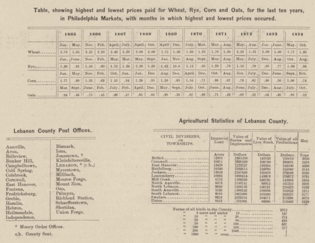
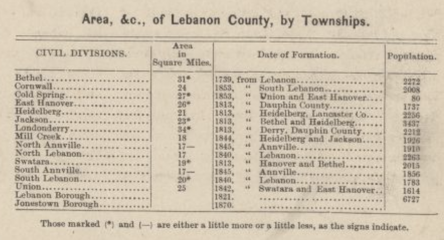
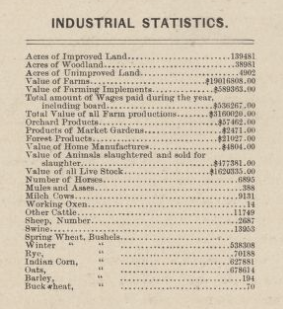
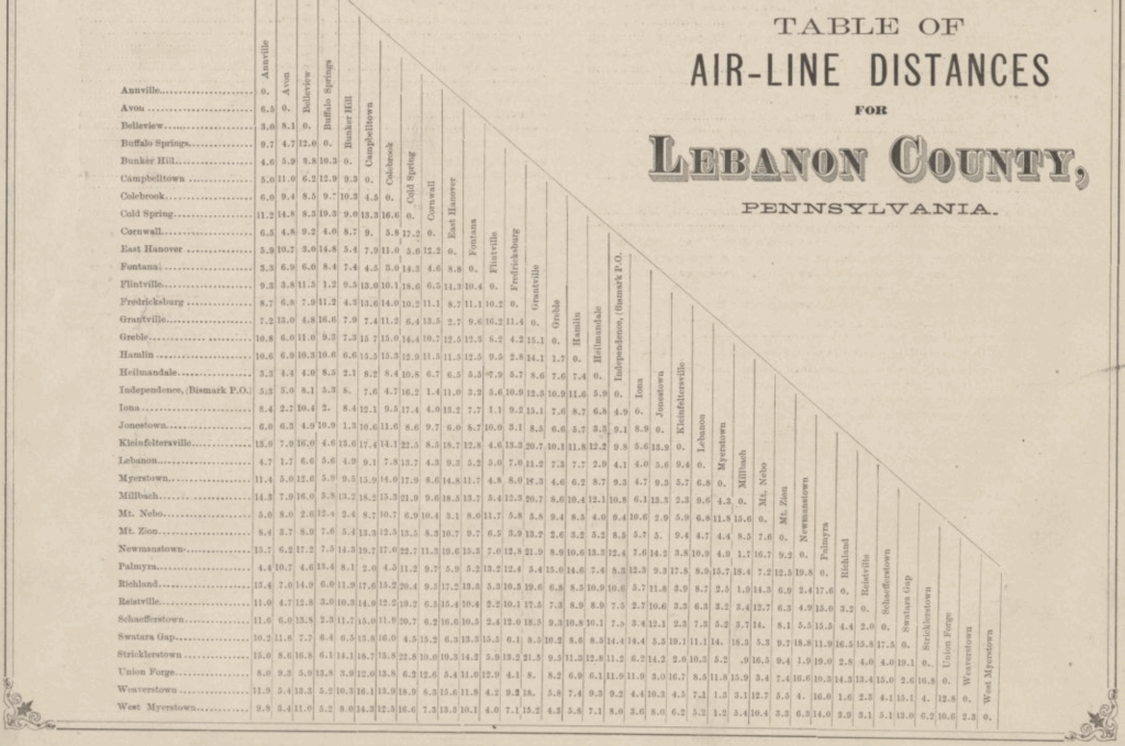
After the title page and table of contents, the atlas provides a chart of populations by county (Lebanon in 1870 contained 34,096 residents) and a table of air-line distances between population centers in the county.
Next come several dense pages of local history, beginning with a bit of florid descriptive text.
“The County of Lebanon has been called, not inappropriately, the Garden Spot of Pennsylvania; and surely no one who has ever passed through it can wonder at the designation. Lying between the far-famed Blue Mountain on the North, and the South Mountain on the South – watered by the Swatara, Quittapahilla, Tulpehocken and many other streams, with a surface somewhat rolling, and beautifully diversified, it is indeed a farmer’s ‘Paradise.’ Entering it at the proper season of the year, the eye falls upon large and luxurious fields of waving grain, large extents planted with Indian corn, while at greater or less intervals, comfortable and commodious farmhouses break the horizon in every direction; often attaining a beauty of architecture and surroundings calculated to strike the beholder, born and reared among the hills of the East or North, where nature deals her favors with a less bounteous hand, with wonder and admiration.”
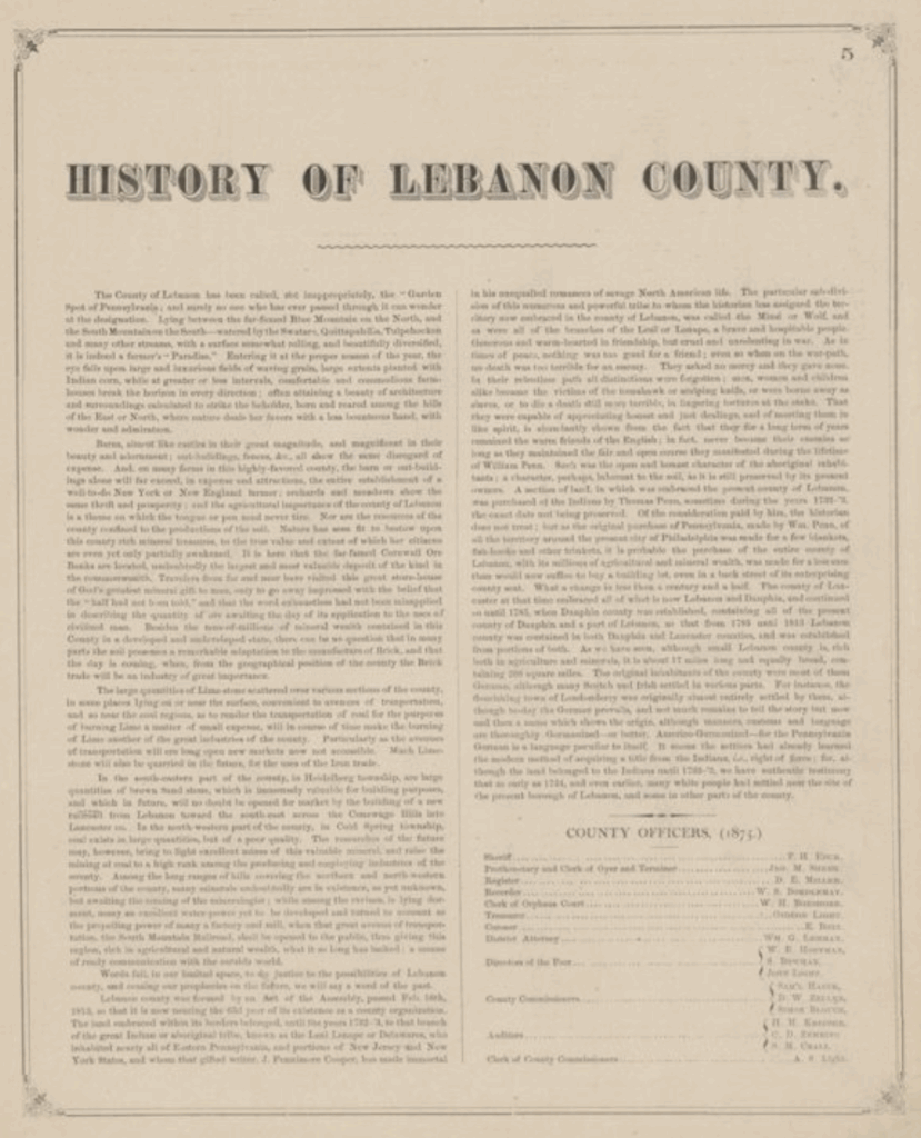
Further expounding on the wealth and luxury of the region, the author adds: “Barns, almost like castles in their great magnitude, and magnificent in their beauty and adornment; out-buildings, fences, &c., all show the same disregard of expense. And, on many farms in this highly-favored county, the barn or out-buildings alone will far exceed, in expense and attractions, the entire establishment of a well-to-do New York or New England farmer; orchards and meadows show the same thrift and prosperity; and the agricultural importance of the county of Lebanon is a theme on which the tongue or pen need never tire.”
After several more lines devoted to the county’s “rich mineral treasures,” Beers regresses to mere history. “Words fail, in our limited space, to do justice to the possibilities of Lebanon county,” he writes, “and ceasing our prophecies on the future, we will say a word of the past.” Accordingly, he discusses the Act of the Assembly on Feb. 16, 1813, that formed the county, as well as the “great Indian or aboriginal tribe, known as the Leni Lenape or Delawares” and the German, Scotch and Irish settlers who inhabited the countryside.
The history of what was at the time Lebanon Borough begins with a goof.
“Lebanon was originally called Steitztown, and was laid out by a Mr. Steitz, about the year 1850. From the first, it became plain that Steitztown was destined to be a place of considerable importance….”
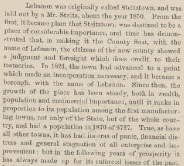
Important, certainly, but the details already are a bit off. According to a local history provided at lebanonpa.org, “Originally known as Steitztown, Lebanon City was founded by George Steitz in 1740.” Oops!
But let’s see what else the atlas has to say.
“Since then, the growth of the place has been steady, both in wealth, population and commercial importance, until it ranks in proportion to its population among the first manufacturing towns, not only of the State, but of the whole country, and had a population in 1870 of 6727. True, as have all other towns, it has had its era of panic, financial distress and general stagnation of all enterprise and improvement; but in the following years oof prosperity it has always made up for its enforced losses of the past. Its business men are shrewd, cautious and far-seeing, and its industries rest mostly on too broad a basis to be shaken by the first breath of adversity. The town is regularly laid out, and occupies a beautiful and healthy situation near the source of the Quittapahilla.”
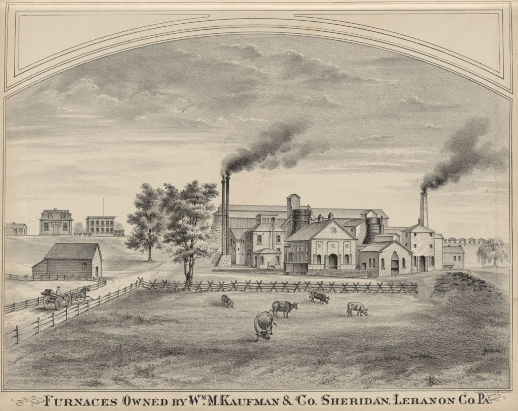
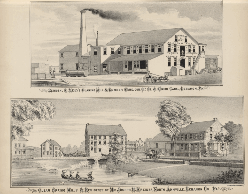
Brief individual histories are provided about specific sites in the county, including places of worship (among them the First Reformed Church of Lebanon, St. John’s Reformed Church, St. Mary’s Church, and Salem’s Evangelical Lutheran Church), newspapers (such as the Lebanon Courier, the Lebanon Advertiser, the Lebanon Valley Standard, Der Pennsylvanier, and the Daily News), and businesses (including Weimer Machine Works and Reinoehl & Meily’s Planing Mills and Lumber Trade), Lebanon furnaces, railroads, and the Union Canal. Additional pages are devoted to the brief histories of local municipalities.
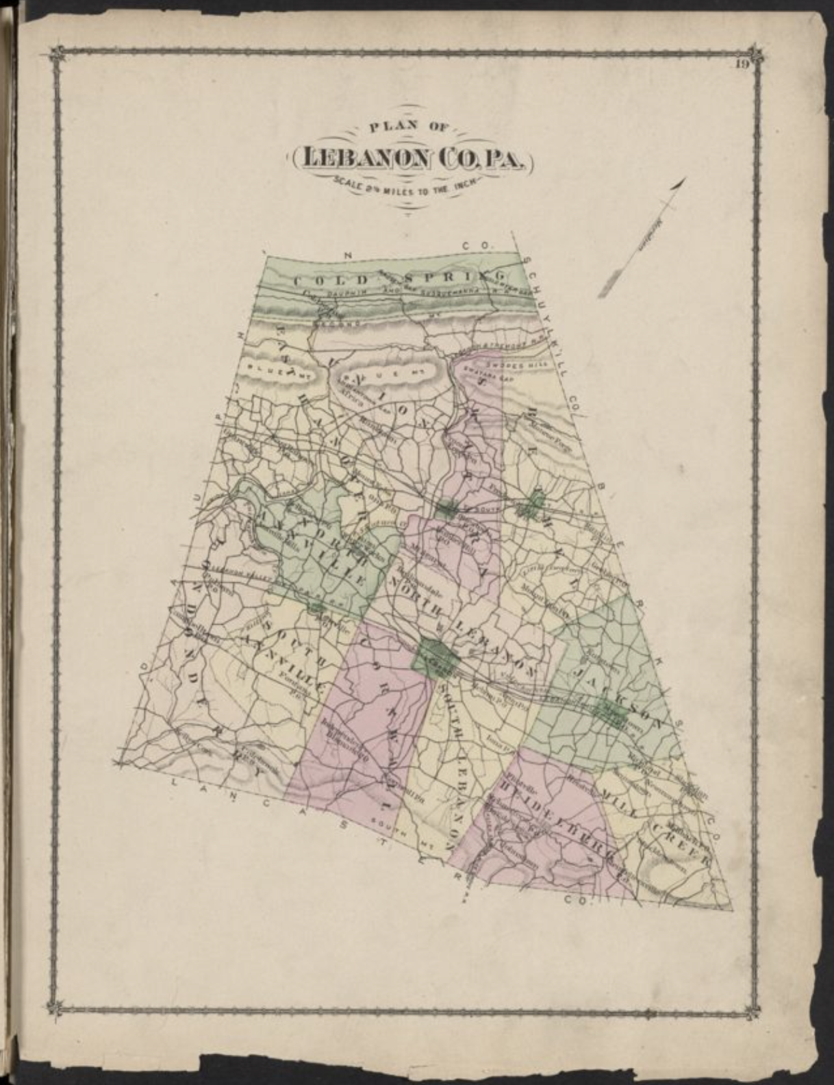
Finally, the maps begin – starting with maps of the United States and Pennsylvania to set the stage.
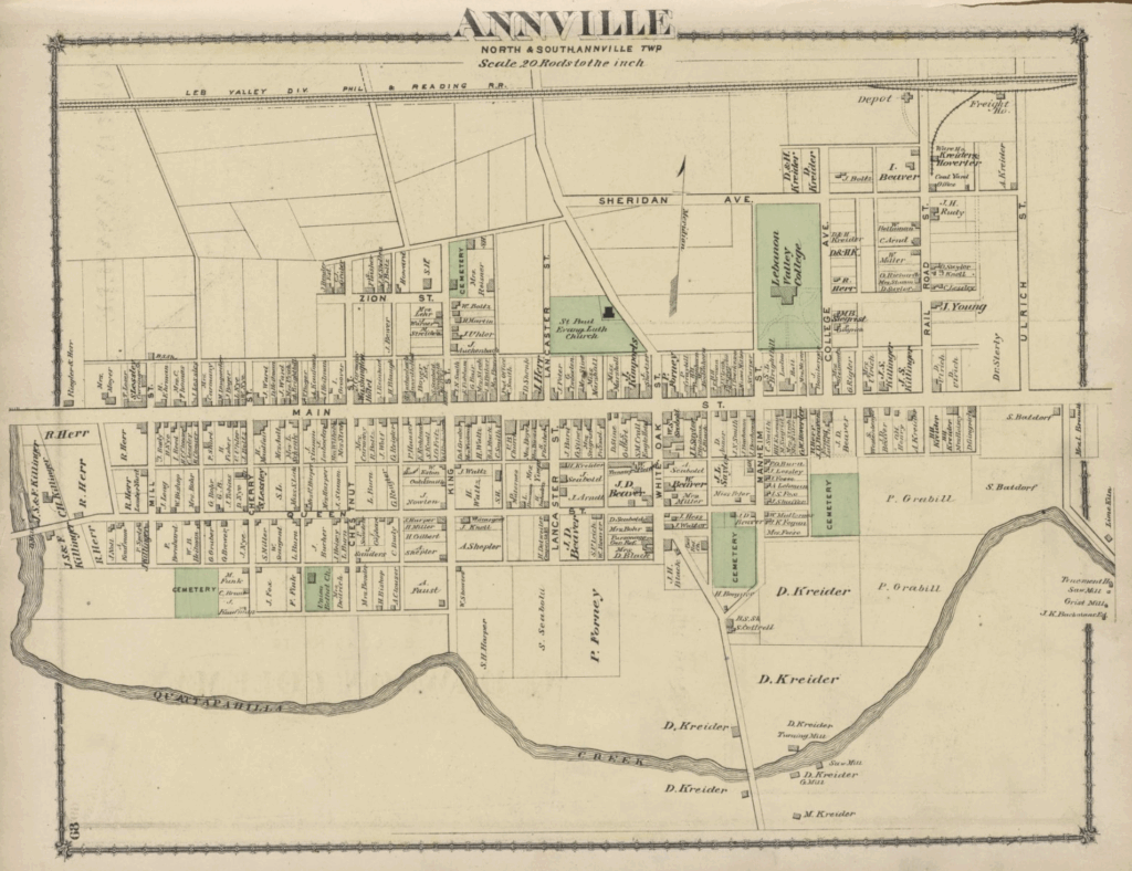
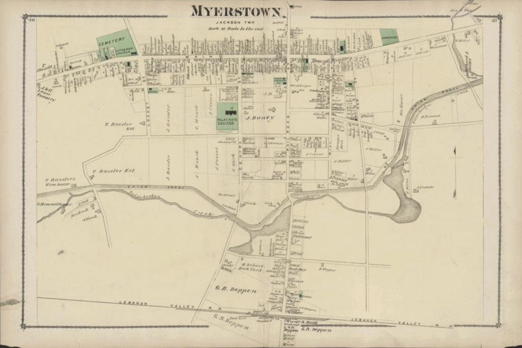
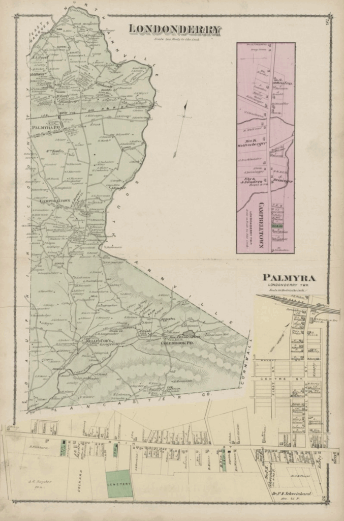
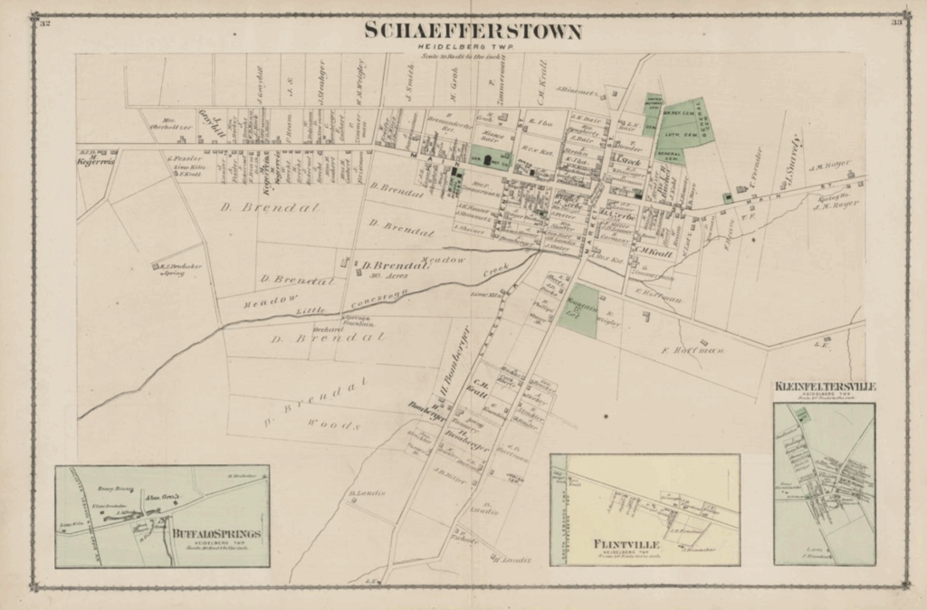
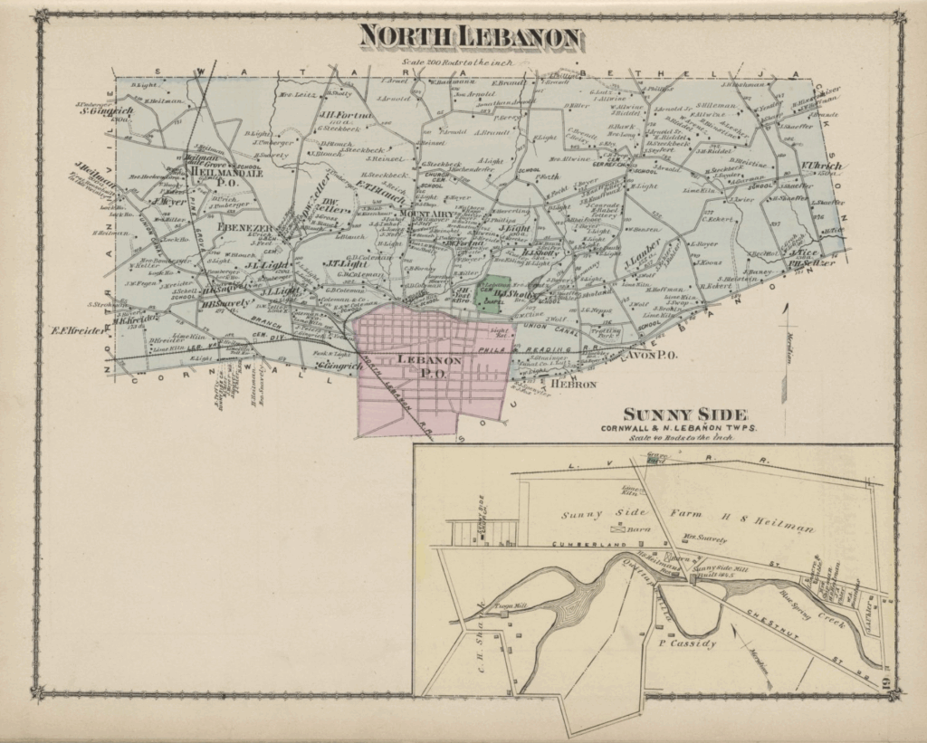
A glance at maps such as Annville and Myerstown show densely packed residential properties, with the names of property owners included with each. The map of Schaefferstown shows small, inset maps of three smaller, nearby communities of Buffalo Springs, Flintville, and Kleinfeltersville, also in Heidelberg Township.
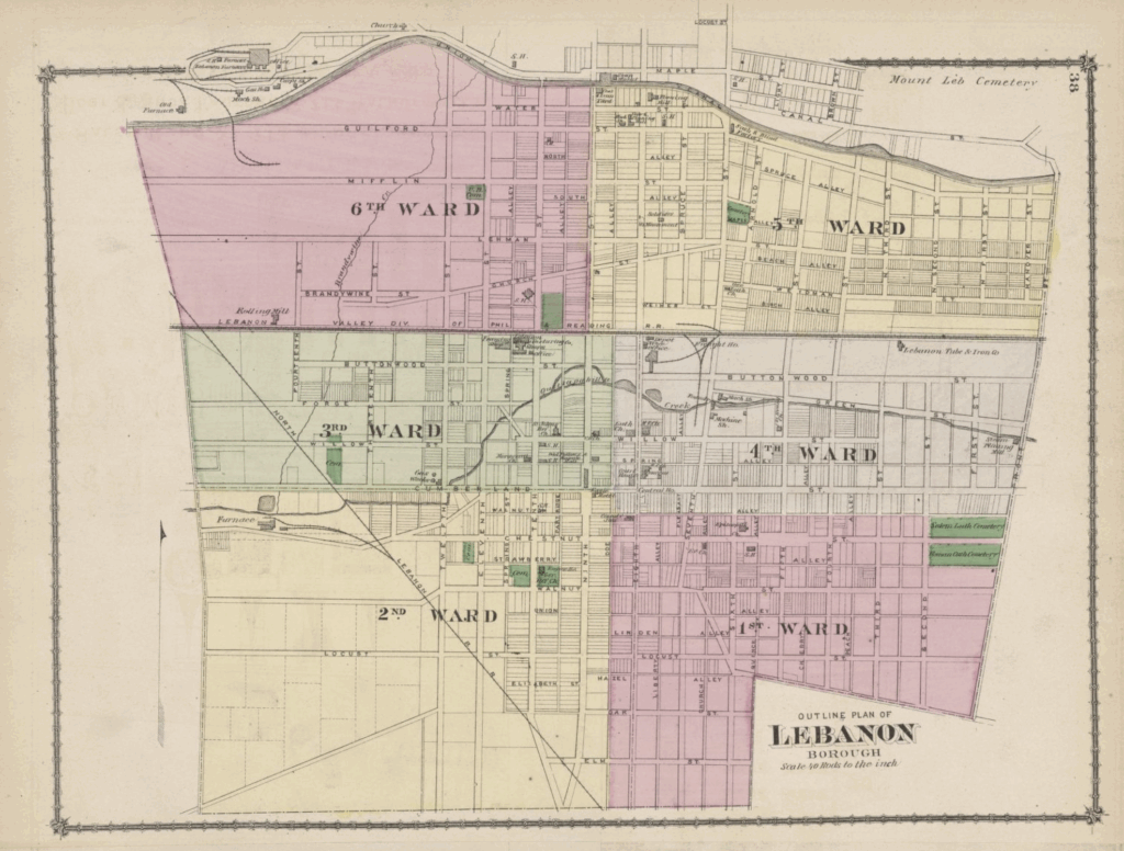
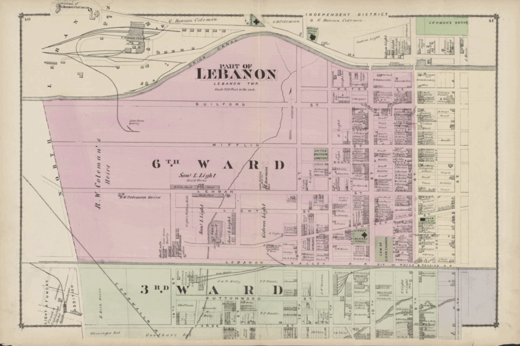
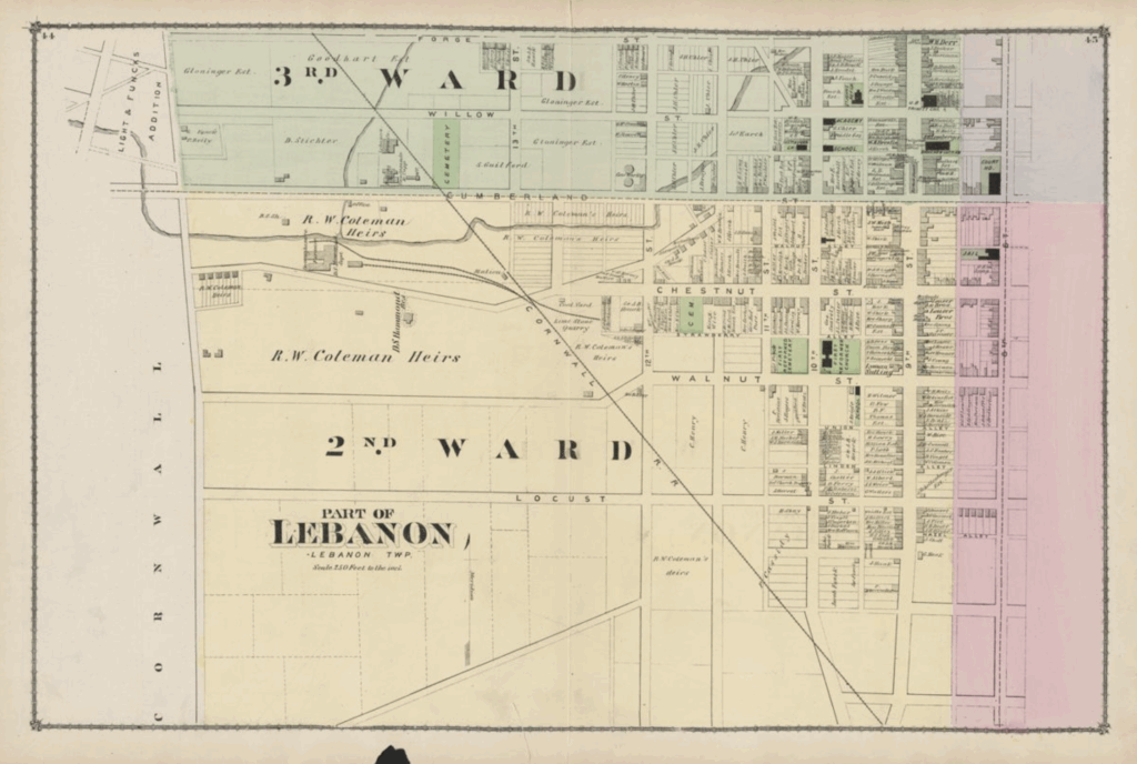
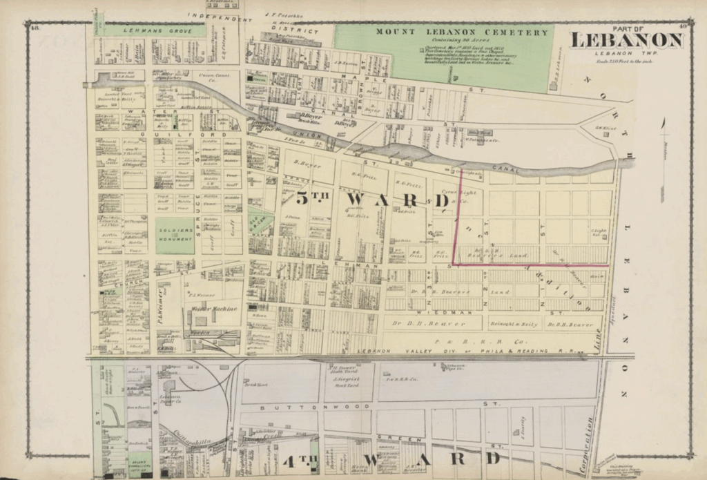
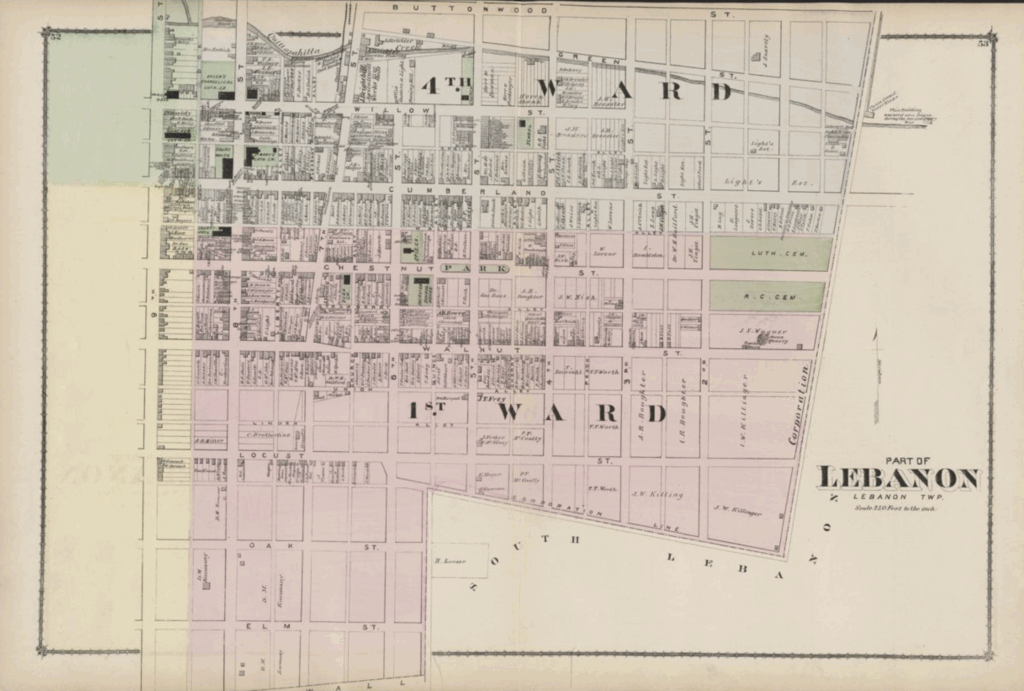
While a map of Lebanon Borough is scarce of detail, given the size of the area covered, it provides a nice overview of the borough’s overall shape and the neatly organized streets within. A further four maps divide the borough into its respective wards, showing far more detail such as individual property owners, schools, cemeteries, a sprawling “R.W. Coleman Heirs” property between Cumberland and Walnut streets, the Soldiers Monument at Spruce and Lehman, a brick yard, a stock yard, and much, much more.
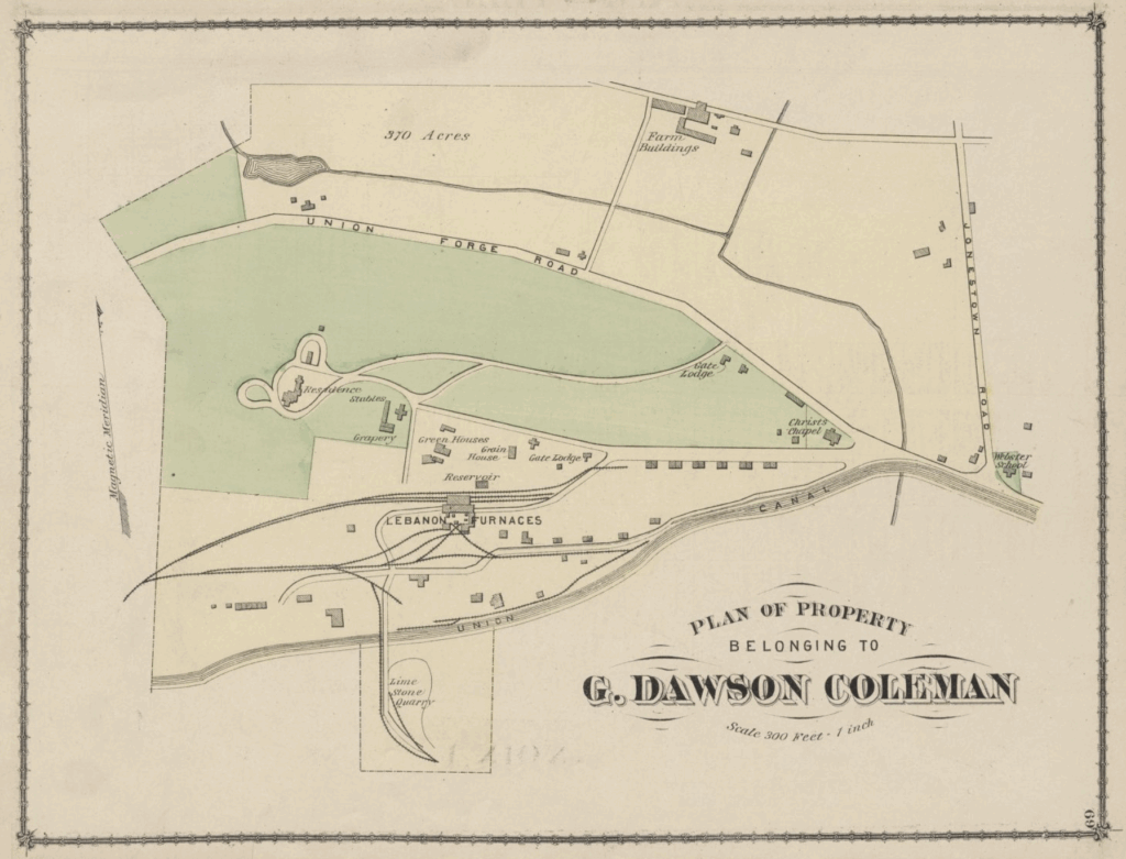
The property belonging to G. Dawson Coleman gets its own map, with details including the residence, stables, grapery, greenhouses, gatehouse, gate lodge, and reservoir, as well as the Lebanon Furnaces themselves and nearby limestone quarry, divided by the Union Canal.
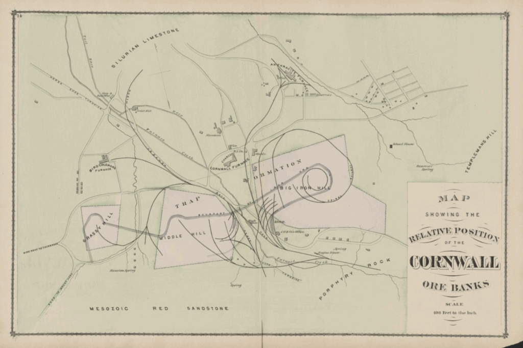
A map showing the “relative position of the Cornwall ore banks” provides some fine geological details, such as an area of silurian limestone (limestone formed between 400 million and 500 million years ago), porphyry (volcanic) rock, and Mesozoic red sandstone, as well as the big iron hill that provided so much ore to the furnace.
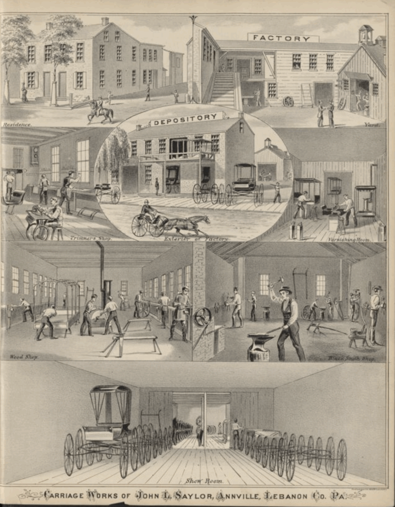
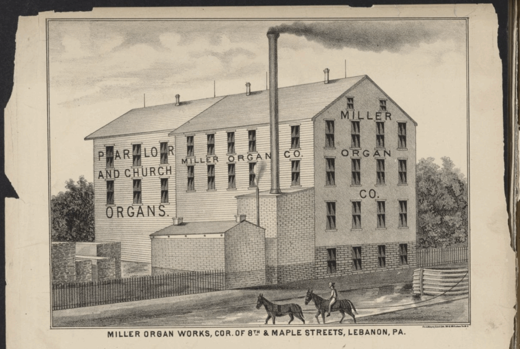
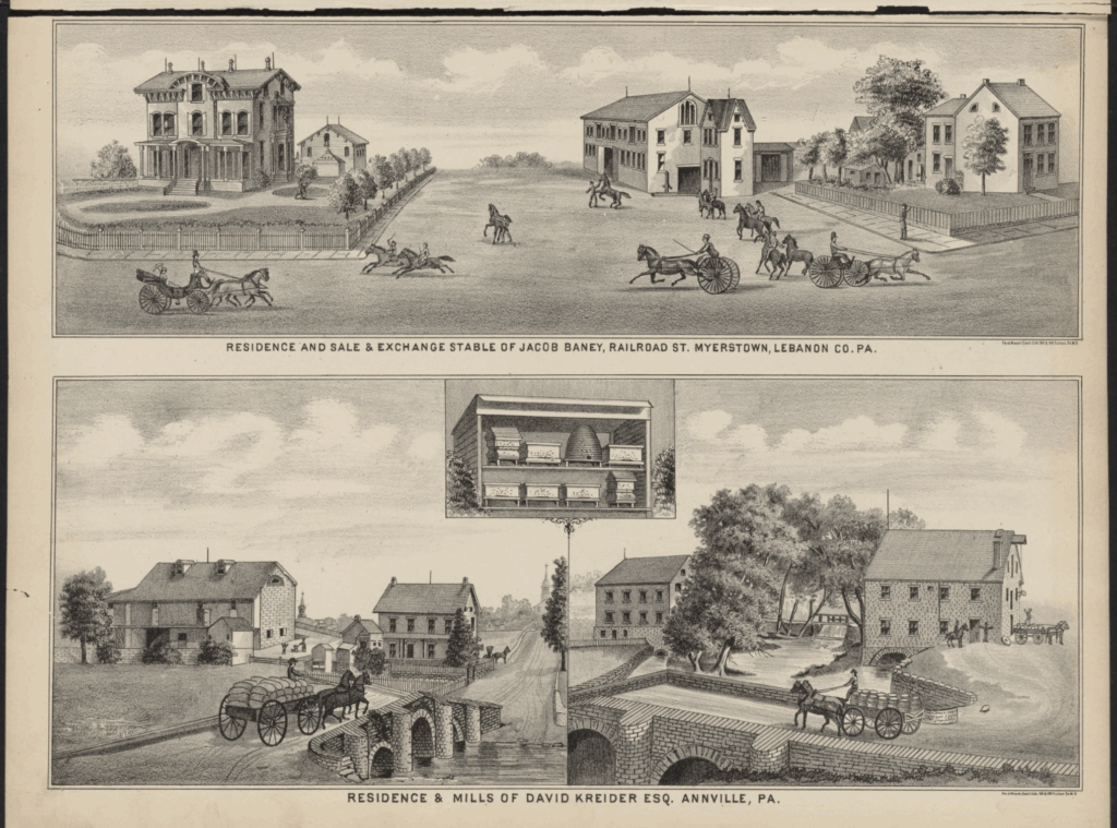
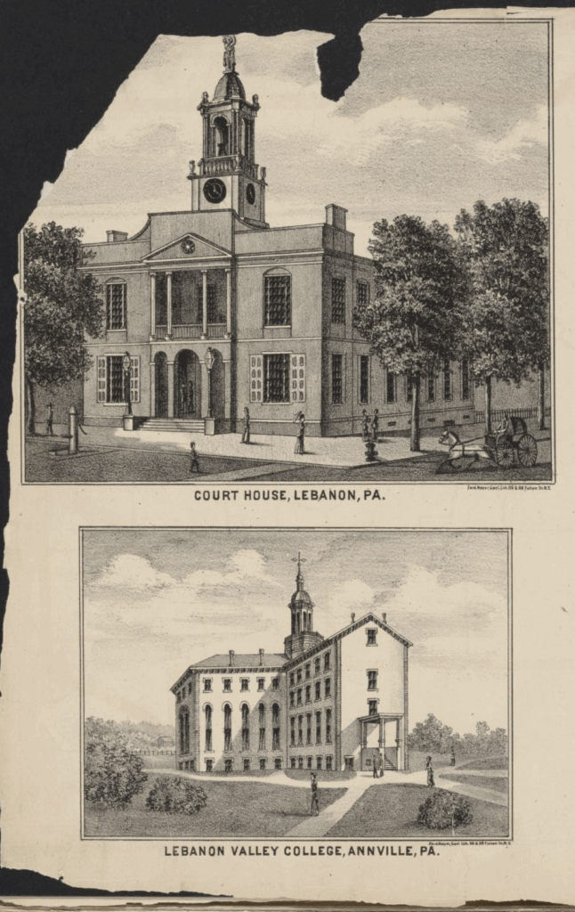
There are also a fair number of sketches of prominent locations in the area, all presented as stylish black-and-white ink drawings.
At the end, a few pages of business notices, listing the region’s merchants and hotel proprietors, farmers and physicians, blacksmiths, carpenters, mechanics, and millwrights, attorneys, book binders, grocers, and teachers.
If you like local history, please enjoy this selection of historical pieces previously featured by LebTown.
Read More:
- How Mount Gretna went from a ‘howling wilderness’ to a ‘paradise for visitors’
- Who was Governor Dick? Mystery of peak’s name traces to enslaved worker
- Light’s Fort: Lebanon’s oldest and most mysterious building
- Fort Swatara: Lebanon County’s garrison during the French and Indian War
- The Heinrich Zeller House (Fort Zeller): Lebanon County’s secluded historical treasure
Questions about this story? Suggestions for a future LebTown article? Reach our newsroom using this contact form and we’ll do our best to get back to you.

Be part of Lebanon County’s story.
Cancel anytime.
Monthly Subscription
🌟 Annual Subscription
- Still no paywall!
- Fewer ads
- Exclusive events and emails
- All monthly benefits
- Most popular option
- Make a bigger impact
Already a member? Log in here to hide these messages
Trustworthy local news is built on facts. As Lebanon County’s independent news source, LebTown is committed to providing timely, accurate, fact-based coverage that matters to you. Support our mission with a monthly or annual membership, or make a one-time contribution. Cancel anytime.